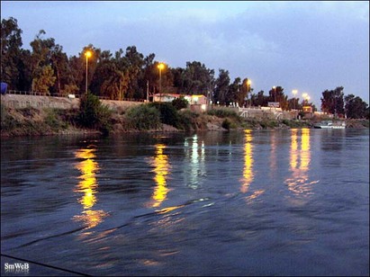
The Tigris River
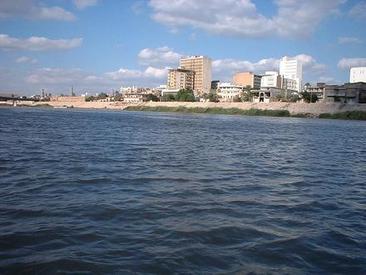
The Tigris River is the eastern member of the two great rivers that define Mesopotamia, the other being the Euphrates. The river flows south from the mountains of southeastern Turkey through Iraq.
The Tigris is 1,850 km long, rising in the Taurus Mountains of eastern Turkey about 25 km southeast of the city of Elazig and about 30 km from the headwaters of the Euphrates. The river then flows for 400 km through Turkish territory before becoming the border between Syria and Turkey. This stretch of 44 km is the only part of the river that is located in Syria. The remaining 1,418 km are entirely within the Iraqi borders.
The Tigris unites with the Euphrates near Basra, and from this junction to the Persian Gulf the mass of moving water is known as the Shatt-al-Arab. According to Pliny and other ancient historians, the Euphrates originally had its outlet into the sea separate from that of the Tigris.
Baghdad, the capital of Iraq, stands on the banks of the Tigris. The port city of Basra straddles the Shatt al-Arab. In ancient times, many of the great cities of Mesopotamia stood on or near the Tigris, drawing water from it to irrigate the civilization of the Sumerians. Notable Tigris-side cities included Nineveh, Ctesiphon, and Seleucia, while the city of Lagash was irrigated by the Tigris via a canal dug around 2400 BC.
Euphrates, Iraq
The Euphrates is the longest and one of the most historically important rivers of Western Asia. Together with the Tigris, it is one of the two defining rivers of Mesopotamia. Originating in eastern Turkey, the Euphrates flows through Syria and Iraq to join the Tigris in the Shatt al-Arab, which empties into the Persian Gulf.The ecoregion is characterized by two large rivers, the Tigris and Euphrates. The rivers have several small tributaries which feed into the system from shallow freshwater lakes, swamps, and marshes, all surrounded by desert. The hydrology of these vast marshes is extremely important to the ecology of the entire upper Persian Gulf. Historically, the area is known as Mesopotamia. As part of the larger Fertile Crescent, it saw the earliest emergence of literate urban civilization in the Uruk period, for which reason it is often dubbed the "Cradle of Civilization".
In the 1980s, this ecoregion was put in grave danger as the Iran–Iraq War raged within its boundaries. The wetlands of Iraq, which were inhabited by the Marsh Arabs, were completely dried out, and only recently have shown signs of recovery.
The Tigris-Euphrates Basin is primarily shared by Turkey, Syria and Iraq, with many Tigris tributaries originating in Iran. Since the 1960s and in 1970s, when Turkey began the GAP project in earnest, water disputes have regularly occurred in addition to the associated dam's effects on the environment. In addition, Syrian and Iranian dam construction has also contributed to political tension within the basin, particularly during drought.
TouristLake of Habbaniyah
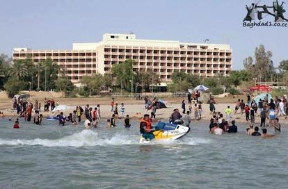
This lakes is one of the major tourist attractions in the Middle East. Opened in 1979 and it has been set up on the shores where the city of Habbaniyah which includes many facilities: - Is a low ground located to the south of the city of Ramadi, for the purpose of storing water about 3.3 billion cubic meters and bring 2.7 billion cubic meters to the Euphrates River in season of Sayhood and this project is controlled by Al-Rumaadi dam . and from the south Habbaniyah Lake and Razzaza lake linked by stream of water, and the disposal of excess water for the energy storage of the Al-Habbaniyah lake to Al- Razaza, which can accommodate storage of 26 billion cubic meters. A tourist city has been set up on this lake. The tourist city in Habbaniyah considered the largest tourist city in the Middle East .. It is located at a distance (84 km) on the west of Baghdad on the road to Baghdad - Ramadi, it has been erected on an area of nearly square kilometer, and extends into the lake along a few hundred meters away. The tourist city of Habbaniyah Consists of: - The hotel from the first class level of six floors containing the ground floor in addition to the management room, the reception and booking, halls for rest, conferences, film screenings, three restaurants and bars , summer and winter swimming pool ,a library and a hall for the Games and each floor includes of the six floors (47) double bedroom and six wings make up a whole (600) beds, each containing a bathroom and a TV special and conditioned centrally. There is a nightclub on the top floor of the hotel
lake sahwa
Saveh Lake is a lake with salted water closed to the province of Al Muthanna in southern Iraq at a distance of several kilometers from the center town city of Samawah.
The lake is surrounded by a natural wall of limestone re-close the same when you break the speed of hardening of the material as limestone in water and contains a very small fish having a high fat, melt completely, when trying to cook and supplied with water from this lake, the flow of water under the ground.
It is customary among the inhabitants of the region, that the waters of the lake may floods significantly on the day of the birth of the Prophet Muhammad (r) the flooding of the lake is one of the historical events which told him on the birth of the Prophet (r). Grew up around a tourist site, restaurants and was alive with tourists Iraqis and Arabs in the eighties of the last century but now is the same. If any tourist site in Iraq was hit by neglect and deterioration became as traces of many centuries
Mosul Dam
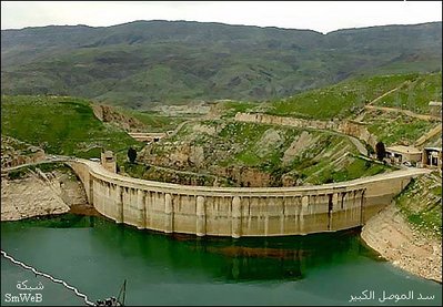
Mosul Dam or Chambarakat Dam, formerly known as Saddam Dam, is the largest dam in Iraq. It is located on the Tigris River in the western governorate of Ninawa, upstream of the city of Mosul. The hydroelectric dam holds, at full capacity, about 11.1 cubic kilometres (2.7 cu mi) of water and provides electricity to the 1.7 million residents of Mosul. The dam's main 750 MW power station contains four 187.5-MW Francis turbine-generators. A pumped-storage hydroelectricity power plant with a capacity of 240 MW and a run-of-the-river dam downstream with a 62 MW capacity also belong to the Mosul Dam scheme. It is ranked as the fourth largest dam in the Middle East, measured by reserve capacity, capturing snowmelt from Turkey, some 70 miles (110 km) north.Built on a karst foundation, concerns over the dam's instability have led to major remediation and rehabilitation efforts since the 2003 invasion of Iraq.
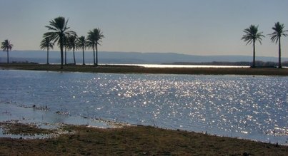
Lake Tharthar
Lake Tharthar, known in Iraq as Buhayrat ath Tharthar, is a lake situated 120 kilometers north of Baghdad between the Tigris and the Euphrates rivers. It is the largest lake in Iraq. The construction of several dams has made it an important source for irrigation. Its size shrinks and expands dramatically with the seasons. The lake is deep and nutrient poor; there is very little vegetation except for sparse shrubs, some dense patches of growth and scattered Ziziphus trees. The area is farmed thanks to the use of tube-wells. A few sheep also graze in the area. The lake is threatened due to overfishing. This area was known colloquially as Wadi Tharthar.
Dukan Dam
The Dukan Dam is a multi-purpose concrete arch dam in As Sulaymaniyah Governorate, Iraq. It impounds the Little Zab, thereby creating Lake Dukan. The Dukan Dam was built between 1954 and 1959 whereas its power station became fully operational in 1979. The dam is 360 metres (1,180 ft) long and 116.5 metres (382 ft) high and its hydroelectric power station has a maximum capacity of 400 MW.
The Dukan Dam was built between 1954 and 1959 as a multi-purpose dam to provide water storage, irrigation and hydroelectricity. The design for the dam was carried out by the British engineering company Binnie & Partners. Prior to the flooding of Lake Dukan, the area has been subjected to archaeological research to investigate as many archaeological sites as possible. An archaeological survey in the Ranya Plain documented some 40 archaeological sites with evidence for occupation ranging from the sixth millennium BCE up to the present. Five of these sites were then excavated: Tell Bazmusian, ed-Dem, Kamarian, Qarashina and Tell Shemshara. The excavations at Tell Bazmusian revealed a temple dating to the second millennium BCE.At Tell Shemshara, an early-sixth millennium BCE village was excavated, as well as an early-second millennium BCE palace with a small archive of clay tablets. The inhabitants of some 50 villages in the flooded area, around 1,000–1,200 families, were resettled to the west of the lake. The power station was designed in 1973 by the Russian company Hydroproject and became operational in 1979. Due to lack of maintenance and repairs, the power station has underperformed and is now, after 30 years of service, due for replacement
The Dukan Dam was built between 1954 and 1959 as a multi-purpose dam to provide water storage, irrigation and hydroelectricity. The design for the dam was carried out by the British engineering company Binnie & Partners. Prior to the flooding of Lake Dukan, the area has been subjected to archaeological research to investigate as many archaeological sites as possible. An archaeological survey in the Ranya Plain documented some 40 archaeological sites with evidence for occupation ranging from the sixth millennium BCE up to the present. Five of these sites were then excavated: Tell Bazmusian, ed-Dem, Kamarian, Qarashina and Tell Shemshara. The excavations at Tell Bazmusian revealed a temple dating to the second millennium BCE.At Tell Shemshara, an early-sixth millennium BCE village was excavated, as well as an early-second millennium BCE palace with a small archive of clay tablets. The inhabitants of some 50 villages in the flooded area, around 1,000–1,200 families, were resettled to the west of the lake. The power station was designed in 1973 by the Russian company Hydroproject and became operational in 1979. Due to lack of maintenance and repairs, the power station has underperformed and is now, after 30 years of service, due for replacement
